When you click on links to various merchants on this site and make a purchase, this can result in this site earning a commission. Affiliate programs and affiliations include, but are not limited to, the eBay Partner Network.
thanks for correcting me but just wanted an answer -you knew what I meant - if you can't give an answer just ignore the question next time please -and by the way A nice person gave me a simple correct answer
Depends on the year. In 14 and 15 there wasn't Apple car play or Android Auto so nav was useful (so some). My 15 is a 2lt with PDr and nav and I still use my phone for nav purposes.
I guess this is as good a place as any to ask.
If the car HAS factory navigation can one override it with Android Auto or Apple Car Play for "better" nav ?
Yes. I rarely use the built in Nav. I almost always use Waze or Google. Even if out in the desert with spotty cell coverage you can pre load Google maps for the area.
Never understood getting the NAV. For me a complete waste of money.
You would not feel that way if you ever got lost in the middle of nowhere and there was no phone service. It has happened to me a number of times, since, I have a tendency to explore an interesting country road. Or, a car meet at someone's Ranch. It also does not tell Google where I am at.
Plus, I got the new update on sale for $99 and it has added many features. I was traveling down PCH to Malibu for a drive. I decided to go back and made a three point turn at Mulholland Highway. The road had a closed sign on it for repair. As, soon as I turned into it, the Nav Voice told me the street was closed. That is a great drive for fun!
Yes. I rarely use the built in Nav. I almost always use Waze or Google. Even if out in the desert with spotty cell coverage you can pre load Google maps for the area.
So if I get NAV in the car I can use either the car's NAV, or use Waze, OR Google via my phone, yes ?
If I do NOT have NAV in the car I can use Apple Play or Android to connect (depending on my phone of course) and use Waze or Google Maps, correct ?
I have a minimal data plan with my phone service as I am in front of my computer at home a good part of the day and find no need to use said phone while I'm out. I can go some months without using it at all.
So then the phone can navigate with its GPS function IF a map is downloaded ? Without using data ?
Is that Google only ? Or can Waze download maps as well ?
Any idea roughly how much area can be downloaded so as not to overload one's phone's memory ? I expect, unless I was going on a long trip, I would simply download the southern half of Florida as that is where I live.
This is what it shows on the Chevy Build & Buy website (in addition to what is on the LT2 )
Custom leather-wrapped interior (information panel, door panels, center console cover and seats)
Sueded microfiber upper interior trim
Performance Data Recorder (optional on 1LT/2LT)
Napa leather-appointed seating surfaces
Navigation (optional on 1LT/2LT)
Instrument panel in interior color
For that $5245 you are getting some "different Interior" materials like the sueded microfiber headliner and pillars (if you think that is "better.") Also the word "Leather" in a C7 is a bit confusing. Having looked carefully at what I got in my 3LT 2014 compared to my 2017 2LT what you can conclude is yes, you get "real leather seating surfaces." But even the seat bolsters are NOT "real leather" (a former GM employee said in tests of bolster durability they selected other than leather.) What other surfaces that look leather are, is not clear. GM calls them soft touch. They are eather synthetic leather (GM coins with the Mulan name) or vinyl. Mulan, like other man made leather is ~40% ground up leather scrapes as a filler and is made similar to vinyl. Some may perceive as better BUT as you note, there are reports of that Mulan leather shrinking and pulling away from openings on the dash. Since this shrinking issue is not reported on 1LT and 2LT's it would appear their dash material in vinyl.
My experience with the GM NAV was one reason I got just a 2LT in 2017. It's not as good as what I get for free updates for in my old Garman. Now I mostly use Apple Car Play that displays on my center screen with my iPhone and is updated free. GM still charges over $200 for an update. One advantage of the GM NAV is it does display in HUD.
The other reason is GM got "cheap: on most interior colors after 2015! My 2014 had full interior dash and door panel "leather color" that looked great with my Kalahari 3LT. For 2019 only "Splice Red" has that full color treatment. If I wanted that color would have considered but not Kalahari (and most colors that are similar) that looks like a patch work quilt to me. I realize esthetics are personal.
The PDR, if desired, is reported to be fine. It can be ordered with a 2LT. These can be also be purchased from aftermarket sources but are not integrated into the cars system.
With Apple Car Play NAV Displays on the FULL Center Screen with My iPhone Connected in the Center Console
Difference Between My 3LT 2014 and Current 3LT Interiors Except Spice Red
Yours looks the best. Especially the competition seats. I have those also, but they aren't that comfortable to me.
Yep the 1LT is stripped, not equipped ......... Right........ One of these days you are going to finally make a post that's accurate and it's going to be such a rare occasion I hope they make it a sticky.
1LT Trim/Equipment Package: A nicely equipped sportscar including 8” touchscreen, Bose AM-FM 9 speaker stereo, 3 month Sirius/XM,MP3, MyLink, OnStar, 4G LTE, 8” HD driver info screen, leather power GT sports seats, power break set/release, power locks/windows, active handling, dual-zone AC, keyless access/start, power tilt/telescopic, leather wrap steering w/flat bottom wheel, cruise control, tire pressure monitor, driver, passenger and side airbags, carbon fiber hood, Bremo 4-piston disc brakes, rear view camera, coup- body color painted carbon fiber roof panels, convertible- power soft-top which can be lowered remotely.
Yep I agree. Some don't think it is BUT IMO it helps with watching for distracted drivers! I have never had an accident with another car in 61 years of driving! I attribute that to knowing where all cars are around me (front, back and sides) all the time, AND LUCK. It is very difficult today with some folks (actually many) having a trained conditioned response, "like Pavlov's Dogs," to look at their cell phone to see ho set the useless text message when it beeps! HUD is a help.
Google maps allows you select a section of the map and force it to download (instructions here). Another option is https://maps.me/app/ it allows off line navigation. I am sure there are more choices in off-the-grid navigation that are popular with overseas travelers because out-of-country data rates are sky high.
Many apps, like Waze and Apple download the route you selected in case you lose signal at some point on the journey (more info here and here). Honestly on most long trips you rarely need a full, detailed map if covering miles thru "no man's land" areas. For example in South FL just think of Alligator Alley (I-75 toll road) - once you get on you only have two choices over 90 miles: Naples on the west end and Ft Lauderdale on the east end.
Google maps allows you select a section of the map and force it to download (instructions here). Another option is https://maps.me/app/ it allows off line navigation. I am sure there are more choices in off-the-grid navigation that are popular with overseas travelers because out-of-country data rates are sky high.
Many apps, like Waze and Apple download the route you selected in case you lose signal at some point on the journey (more info here and here). Honestly on most long trips you rarely need a full, detailed map if covering miles thru "no man's land" areas. For example in South FL just think of Alligator Alley (I-75 toll road) - once you get on you only have two choices over 90 miles: Naples on the west end and Ft Lauderdale on the east end.
Thanks very much. Appreciate it.
And sure, long trips often just need a local map at the destination. I could easily go from SoFla to Los Angeles by using I-10.
Any idea how much can be preloaded to my smartphone though, to be used any time I wanted to ? My local city ? 50 mile radius ? County ? Entire state of Florida ?
Any idea how much can be preloaded to my smartphone though, to be used any time I wanted to ? My local city ? 50 mile radius ? County ? Entire state of Florida ?
No idea... just depends on phone storage and detail level.
Any idea how much can be preloaded to my smartphone though, to be used any time I wanted to ? My local city ? 50 mile radius ? County ? Entire state of Florida ?
TIA
In Google map download you just draw a box around the area that you want. I’ve only just loaded maps of areas I knew I wouldn’t have cell service. Mostly for off roading or places like Death Valley etc. I suppose you could download Florida but cell service is pretty good state wide. It’s only memory. Probably depends on what’s available on your phone.
I know you can download areas that are quite large. Hundreds of miles across while traveling out West.
I have a 2019 GS A8 2LT and I am very happy with it. IMO the 3LT isn't worth the extra $$$$$. The HUD is amazing as is the memory function. While I don't have the GM Nav/PDR I dont need it as I can send Google Maps to my car ow just use Onstar (which I prefer).
The front camera is a aero saver lol.
For the money the GS 2LT is really the sweet spot .
Google maps allows you select a section of the map and force it to download (instructions here). Another option is https://maps.me/app/ it allows off line navigation. I am sure there are more choices in off-the-grid navigation that are popular with overseas travelers because out-of-country data rates are sky high.
Many apps, like Waze and Apple download the route you selected in case you lose signal at some point on the journey (more info here and here). Honestly on most long trips you rarely need a full, detailed map if covering miles thru "no man's land" areas. For example in South FL just think of Alligator Alley (I-75 toll road) - once you get on you only have two choices over 90 miles: Naples on the west end and Ft Lauderdale on the east end.
thats great info. Thanks for posting.
Question: if you loose cell signal - I understand the benefit of having the maps stored on the phone, but now does your phone know where you are in relationship to said stored map data?
Question: if you loose cell signal - I understand the benefit of having the maps stored on the phone, but now does your phone know where you are in relationship to said stored map data?
If you don't have cell service then your phone doesn't know where you are but you do. It's like having a good paper map on your phone. I still have my maps I have my Rand Mcnallay maps books for every place I was stationed.
Question: if you loose cell signal - I understand the benefit of having the maps stored on the phone, but now does your phone know where you are in relationship to said stored map data?
GPS. The phone knows where you are at all times. The map is pulled from memory rather than the cloud. It’s kinda like magic.
If you don't have cell service then your phone doesn't know where you are but you do. It's like having a good paper map on your phone. I still have my maps I have my Rand Mcnallay maps books for every place I was stationed.
Designer Imagines A Corvette That Looks More Like a Corvette Than the Corvette
Slideshow: A Jaguar designer's personal project imagines what a modern front-engined Corvette might look like if Chevrolet revisited the golden age of the Stingray.




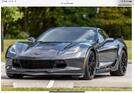


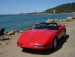


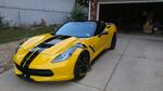


 Just comments on the 3LT
 I realize esthetics are personal.


 One of these days you are going to finally make a post that's accurate and it's going to be such a rare occasion I hope they make it a sticky.


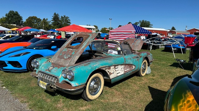



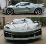

 Yep I agree. Some don't think it is BUT IMO it helps with watching for distracted drivers! I have never had an accident with another car in 61 years of driving! I attribute that to knowing where all cars are around me (front, back and sides) all the time, AND LUCK. It is very difficult today with some folks (actually many) having a trained conditioned response, "like Pavlov's Dogs," to look at their cell phone to see ho set the useless text message when it beeps! HUD is a help.