


Back to reality
Team Owner


Joined: Apr 2001
Posts: 26,794
Likes: 614
From: Elmhurst, IL (West Suburb of Chicago) & Home of MEGA Horsepower
St. Jude Donor '06
Race Director


Joined: Jul 1999
Posts: 12,122
Likes: 30
From: NW Suburb Of Chicago
Cruise-In Photographer
CI 1, 2, 7, 8, 9, 10 Veteran
St. Jude Donor '06 thru '26
It's my fault - I have an appointment Friday morning to swap from winter wheels and tires to the summer set.
Team Owner


Joined: Mar 2007
Posts: 35,194
Likes: 2,130
From: Right Corner Pocket of Illinois
No-IL Events Coordinator
2026 Corvette of the Year Finalist - Unmodified
2025 C6 of the Year Winner - Unmodified
2020 C6 of the Year Finalist - Unmodified
2020 Corvette of the Year Finalist (appearance mods)
2019 C6 of Year Winner (appearance mods)
2018 C6 of Year Finalist
St. Jude Donor '12 thru '26
???
Details for Friday, February 24
Snow showers early with a chance of lingering snow showers later. High 37F. Winds WNW at 10 to 20 mph. Chance of snow 40%. Snow accumulations less than one inch.
Evening: Becoming partly cloudy later with any flurries or snow showers ending by midnight. Low 21F. Winds WNW at 10 to 20 mph. Chance of snow 30%.
Race Director
Joined: Jul 1999
Posts: 12,122
Likes: 30
From: NW Suburb Of Chicago
Cruise-In Photographer
CI 1, 2, 7, 8, 9, 10 Veteran
St. Jude Donor '06 thru '26
???
Details for Friday, February 24
Snow showers early with a chance of lingering snow showers later. High 37F. Winds WNW at 10 to 20 mph. Chance of snow 40%. Snow accumulations less than one inch.
Evening: Becoming partly cloudy later with any flurries or snow showers ending by midnight. Low 21F. Winds WNW at 10 to 20 mph. Chance of snow 30%.
Details for Friday, February 24
Snow showers early with a chance of lingering snow showers later. High 37F. Winds WNW at 10 to 20 mph. Chance of snow 40%. Snow accumulations less than one inch.
Evening: Becoming partly cloudy later with any flurries or snow showers ending by midnight. Low 21F. Winds WNW at 10 to 20 mph. Chance of snow 30%.
Today: Rain before 3pm, then rain and snow. Patchy fog before 9am. High near 41. East wind between 5 and 15 mph, with gusts as high as 20 mph. Chance of precipitation is 90%. Little or no snow accumulation expected.
Tonight: Snow. The snow could be heavy at times. Some thunder is also possible. Low around 31. North northwest wind around 15 mph, with gusts as high as 30 mph. Chance of precipitation is 100%. New snow accumulation of 5 to 9 inches possible.
Tonight: Snow. The snow could be heavy at times. Some thunder is also possible. Low around 31. North northwest wind around 15 mph, with gusts as high as 30 mph. Chance of precipitation is 100%. New snow accumulation of 5 to 9 inches possible.
Team Owner
Joined: Mar 2007
Posts: 35,194
Likes: 2,130
From: Right Corner Pocket of Illinois
No-IL Events Coordinator
2026 Corvette of the Year Finalist - Unmodified
2025 C6 of the Year Winner - Unmodified
2020 C6 of the Year Finalist - Unmodified
2020 Corvette of the Year Finalist (appearance mods)
2019 C6 of Year Winner (appearance mods)
2018 C6 of Year Finalist
St. Jude Donor '12 thru '26
My fault, picking up the Vette tomorrow after work!
 ...WINTER STORM WATCH REMAINS IN EFFECT FROM THIS EVENING THROUGH FRIDAY MORNING...
* TIMING...RAIN IS EXPECTED TO CHANGE TO WET SNOW ACROSS NORTHERN ILLINOIS AND NORTHWEST INDIANA THIS EVENING. SNOW MAY BECOME HEAVY AT TIMES PARTICULARLY DURING THE EVENING HOURS...BEFORE GRADUALLY TAPERING OFF FROM WEST TO EAST LATE TONIGHT INTO EARLY FRIDAY MORNING.
* ACCUMULATIONS...IN EXCESS OF 6 INCHES ARE POSSIBLE IN SOME AREAS.
* MAIN IMPACT...HEAVY WET SNOW MAY FALL AT RATES GREATER THAN AN INCH PER HOUR THIS EVENING. THIS WILL LIKELY RESULT IN QUICK ACCUMULATION OF WET SNOW ON ROADS...RESULTING IN SLIPPERY AND POTENTIALLY HAZARDOUS TRAVEL CONDITIONS.
* OTHER IMPACTS...IN ADDITION TO ACCUMULATION AND SLIPPERY TRAVEL IMPACTS...STRONG WINDS WILL RESULT IN WIND WHIPPED HEAVY WET SNOW CAUSING SEVERELY REDUCED VISIBILITIES THIS EVENING THROUGH TONIGHT. DUE TO THE HIGH LIQUID CONTENT OF THE SNOW...THOSE WITH HEALTH CONCERNS SHOULD USE CAUTION WHEN SHOVELING.
PRECAUTIONARY/PREPAREDNESS ACTIONS...
A WINTER STORM WATCH MEANS THERE IS A POTENTIAL FOR SIGNIFICANT SNOW...SLEET...OR ICE ACCUMULATIONS THAT MAY IMPACT TRAVEL. CONTINUE TO MONITOR THE LATEST FORECASTS.
...WINTER STORM WATCH REMAINS IN EFFECT FROM THIS EVENING THROUGH FRIDAY MORNING...* TIMING...RAIN IS EXPECTED TO CHANGE TO WET SNOW ACROSS NORTHERN ILLINOIS AND NORTHWEST INDIANA THIS EVENING. SNOW MAY BECOME HEAVY AT TIMES PARTICULARLY DURING THE EVENING HOURS...BEFORE GRADUALLY TAPERING OFF FROM WEST TO EAST LATE TONIGHT INTO EARLY FRIDAY MORNING.
* ACCUMULATIONS...IN EXCESS OF 6 INCHES ARE POSSIBLE IN SOME AREAS.
* MAIN IMPACT...HEAVY WET SNOW MAY FALL AT RATES GREATER THAN AN INCH PER HOUR THIS EVENING. THIS WILL LIKELY RESULT IN QUICK ACCUMULATION OF WET SNOW ON ROADS...RESULTING IN SLIPPERY AND POTENTIALLY HAZARDOUS TRAVEL CONDITIONS.
* OTHER IMPACTS...IN ADDITION TO ACCUMULATION AND SLIPPERY TRAVEL IMPACTS...STRONG WINDS WILL RESULT IN WIND WHIPPED HEAVY WET SNOW CAUSING SEVERELY REDUCED VISIBILITIES THIS EVENING THROUGH TONIGHT. DUE TO THE HIGH LIQUID CONTENT OF THE SNOW...THOSE WITH HEALTH CONCERNS SHOULD USE CAUTION WHEN SHOVELING.
PRECAUTIONARY/PREPAREDNESS ACTIONS...
A WINTER STORM WATCH MEANS THERE IS A POTENTIAL FOR SIGNIFICANT SNOW...SLEET...OR ICE ACCUMULATIONS THAT MAY IMPACT TRAVEL. CONTINUE TO MONITOR THE LATEST FORECASTS.
Last edited by Quick Silver Z; Feb 23, 2012 at 08:40 AM.
Team Owner
Joined: Apr 2001
Posts: 26,794
Likes: 614
From: Elmhurst, IL (West Suburb of Chicago) & Home of MEGA Horsepower
St. Jude Donor '06
Don't fret Johnny it not going to do much but get wet and a little slushy, temps are to warm, whatever little amount sticks will melt ASAP! 
Corvette Stories
The Best of Corvette for Corvette Enthusiasts

Top 10 Most Expensive Corvettes Ever Sold on Bring A Trailer
Brett Foote
10 Things Every Corvette Owner Needs (2026 Edition)
Michael S. Palmer
8 Most "Only Corvette Owners Understand" Quirks and Problems
Pouria Savadkouei
10 Reasons the C6 Z06 is Still A Performance Benchmark After 20 Years
Joe Kucinski
How Much Horsepower Every Corvette Engine "LOST" in 1972
Joe Kucinski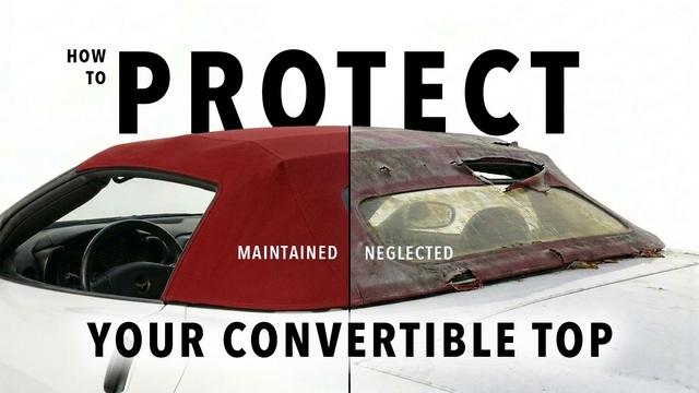
Top 10 DOs and DON'Ts for Protecting Your Convertible Top!
Michael S. Palmer
Top 10 Most Explosive Corvettes Ever Made: Power-to-Weight Ratio Ranked!
Joe Kucinski
150 hp to 1,250 hp: Every Corvette Generation Compared by the Specs That Matter
Joe Kucinski
8 Coolest Corvette Pace Cars (and Replicas) of All Time
Verdad GallardoCHICAGO CREW !


Joined: Nov 2001
Posts: 17,591
Likes: 93
From: We are living in a Bazzaro World everything is upside down half ass backwards !
CI 4-5-6-7-8-9 Veteran
St. Jude Donor '06-'07-'08 & '12

Moderator
Joined: Jul 2005
Posts: 29,353
Likes: 3,887
From: West MI
CF Banner Relay Captain
West MI & JAX/NE Florida
Events Coordinator
St. Jude Donor '11-'17, '21
 They are all freaking out over the 4-8 inches we are
 supposed to get here. Even if they are actually right for once it will all melt (again) when the temps go back up to the 40s Sunday.

Bob, I hope you get Jenny home safe prior!

Le Mans Master

Joined: Jan 2011
Posts: 7,244
Likes: 3
St. Jude Donor '11-'12-'13-'14-'15-'16-'17
Sounds like it could be the worst late this evening and a bit overnight. As others have said, it isn't going to stick around long. It has been an amazing winter so far.
Team Owner
Joined: Mar 2007
Posts: 35,194
Likes: 2,130
From: Right Corner Pocket of Illinois
No-IL Events Coordinator
2026 Corvette of the Year Finalist - Unmodified
2025 C6 of the Year Winner - Unmodified
2020 C6 of the Year Finalist - Unmodified
2020 Corvette of the Year Finalist (appearance mods)
2019 C6 of Year Winner (appearance mods)
2018 C6 of Year Finalist
St. Jude Donor '12 thru '26
Bailed at 3 o'clock when it was coming down in mega chunks! Little flakes now but at this rate Jenny stays put.
Johnny, I guess you know Jimmy is really thinking of you!
Johnny, I guess you know Jimmy is really thinking of you!
CHICAGO CREW !
Joined: Nov 2001
Posts: 17,591
Likes: 93
From: We are living in a Bazzaro World everything is upside down half ass backwards !
CI 4-5-6-7-8-9 Veteran
St. Jude Donor '06-'07-'08 & '12
we have 15 inches in elmwood park all ready looks like 15 more by tomorrow morning
Team Owner
Joined: Apr 2001
Posts: 26,794
Likes: 614
From: Elmhurst, IL (West Suburb of Chicago) & Home of MEGA Horsepower
St. Jude Donor '06

Team Owner
Joined: Apr 2001
Posts: 26,794
Likes: 614
From: Elmhurst, IL (West Suburb of Chicago) & Home of MEGA Horsepower
St. Jude Donor '06
CHICAGO CREW !
Joined: Nov 2001
Posts: 17,591
Likes: 93
From: We are living in a Bazzaro World everything is upside down half ass backwards !
CI 4-5-6-7-8-9 Veteran
St. Jude Donor '06-'07-'08 & '12
well it's 9:10 pm still no snow ! I will let you all know how it is at 4am when I get up for work .......................not that anyone will be up but me !
Thread Starter
Melting Slicks


Joined: Jul 2010
Posts: 2,618
Likes: 20
From: Elk Grove Village
St. Jude Donor '12
Le Mans Master
Joined: Jan 2011
Posts: 7,244
Likes: 3
St. Jude Donor '11-'12-'13-'14-'15-'16-'17
I'll think of you my friend as I hide under the covers until I wake at 7 or so.
 Eight?
  Nine??
Drive safely everyone.
Le Mans Master
Joined: Jan 2011
Posts: 7,244
Likes: 3
St. Jude Donor '11-'12-'13-'14-'15-'16-'17
Burning Brakes

Joined: Apr 2006
Posts: 850
Likes: 10
From: Athens OH
Mid to high 40's Sunday, should take care of what comes down tonight.
Ugg, wonder if we will be buried when I get up at 5 for work?
Might just stay home, don't have to go out until late afternoon if I do.
Ugg, wonder if we will be buried when I get up at 5 for work?
Might just stay home, don't have to go out until late afternoon if I do.