


Navigation sucks!!!
Pro


Joined: Mar 2009
Posts: 612
Likes: 24
From: Belleville Illinois
The one in my 08 worked like a champ even with the european maps loaded in Germany. It did however still suck because it's old technology. The screen looked like crap compared to modern high res displays. At least the C6 has a double din hole in the dash where you can install an aftermarket one and still have it look nice.
Safety Car


Joined: Sep 2006
Posts: 4,075
Likes: 6
From: Wilmington NC
All you want to know about the NAV System 
http://www.bowlinggreenassemblyplant.com/home.htm
Go to, CAR INFO > Instructions

http://www.bowlinggreenassemblyplant.com/home.htm
Go to, CAR INFO > Instructions
The problem is that if you don't use it on a daily basis, when you do want to use it, unless you have a photographic memory, you need to pull out the instructions. Totally unacceptable even when this generation NAV was introduced. As has been mentioned, the NAV has great features but the interface to access them is archaic and unless you use it on a regular basis or are doing only the basics, you need to pull out the instructions. This is not true with my Garmin which I use infrequently as well.
Last edited by j_digi454; Apr 21, 2012 at 06:12 PM.
Race Director

Joined: Oct 2010
Posts: 14,475
Likes: 785
From: Las Vegas NV
The problem is that if you don't use it on a daily basis, when you do want to use it, unless you have a photographic memory, you need to pull out the instructions. Totally unacceptable even when this generation NAV was introduced. As has been mentioned, the NAV has great features but the interface to access them is archaic and unless you use it on a regular basis or are doing only the basics, you need to pull out the instructions. This is not true with my Garmin which I use infrequently as well.
Race Director


Joined: Oct 2005
Posts: 14,555
Likes: 1,255
From: Saint Albans, WV
We can close it after you can prove the $1700 Pioneer AVIC Z130BT I had installed in my 2011 Sierra HD and sold it to get rid of it is anything other than less effective as the factory nav.
Safety Car
Joined: Mar 2010
Posts: 4,293
Likes: 46
From: FL
Crap! How did you know? 
First of all: at $1,700, you didnt do much shopping around. Even when these first appeared on the market, they could be found for $1,200 easy. Secondly, the navigation in the Pioneer is really, really, really nice. Its very comparable to my TomTom unit and is fast. Recalculated routes on the fly and has GPS data on par with the best on the market. It is night and day ahead of the stock unit. The two arent even in the same league.
Heres what you get in the Pioneer X930BT (the unit I was mentioning)
Double-DIN AM/FM radio, DVD, DVD-R/RW, DVD+R/RW, CD, CD-R/RW, VCD, MP3/WMA/AAC, JPEG, DivX, navigation receiver
2D/3D GPS navigation with maps of US, Alaska, Hawaii, Canada, and Puerto Rico; spoken street names; lane guidance
MOSFET 50 Watts x 4 peak power with three 2V RCA preamp outputs for system expansion
6.1-inch touchscreen display with widescreen 16:9 aspect ratio and WVGA (800x480) pixel resolution
Features built-in Bluetooth, Pandora integration, direct iPod control, playback from USB and microSD, auxiliary input
A volume **** (these are a rare commodity)
.....and $100! Did I make my case?
Corvette Stories
The Best of Corvette for Corvette Enthusiasts

Every 2027 Corvette Engine Explained
Joe Kucinski
Designer Imagines A Corvette That Looks More Like a Corvette Than the Corvette
Verdad Gallardo
10 Ugly Corvettes That We Still Kinda Love
Joe Kucinski
Top 10 Most Expensive Corvettes Ever Sold on Bring A Trailer
Brett Foote
10 Things Every Corvette Owner Needs (2026 Edition)
Michael S. Palmer
8 Most "Only Corvette Owners Understand" Quirks and Problems
Pouria Savadkouei
10 Reasons the C6 Z06 is Still A Performance Benchmark After 20 Years
Joe Kucinski
How Much Horsepower Every Corvette Engine "LOST" in 1972
Joe Kucinski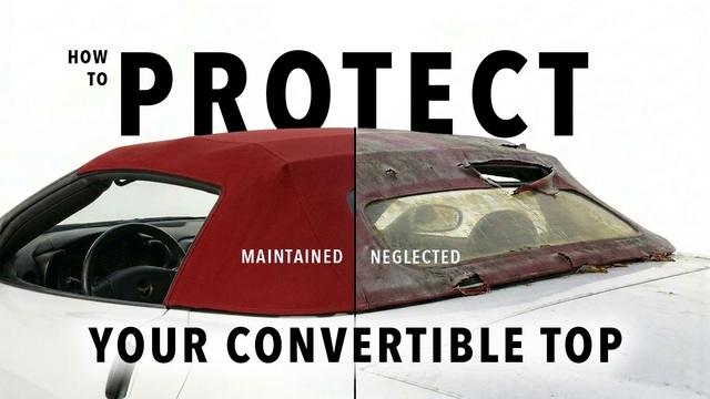
Top 10 DOs and DON'Ts for Protecting Your Convertible Top!
Michael S. PalmerRace Director
Joined: Oct 2005
Posts: 14,555
Likes: 1,255
From: Saint Albans, WV
Crap! How did you know?
First of all: at $1,700, you didnt do much shopping around. Even when these first appeared on the market, they could be found for $1,200 easy. Secondly, the navigation in the Pioneer is really, really, really nice. Its very comparable to my TomTom unit and is fast. Recalculated routes on the fly and has GPS data on par with the best on the market. It is night and day ahead of the stock unit. The two arent even in the same league.
Heres what you get in the Pioneer X930BT (the unit I was mentioning)
Double-DIN AM/FM radio, DVD, DVD-R/RW, DVD+R/RW, CD, CD-R/RW, VCD, MP3/WMA/AAC, JPEG, DivX, navigation receiver
2D/3D GPS navigation with maps of US, Alaska, Hawaii, Canada, and Puerto Rico; spoken street names; lane guidance
MOSFET 50 Watts x 4 peak power with three 2V RCA preamp outputs for system expansion
6.1-inch touchscreen display with widescreen 16:9 aspect ratio and WVGA (800x480) pixel resolution
Features built-in Bluetooth, Pandora integration, direct iPod control, playback from USB and microSD, auxiliary input
A volume **** (these are a rare commodity)
.....and $100! Did I make my case?
Safety Car
Joined: Mar 2010
Posts: 4,293
Likes: 46
From: FL
Ive installed*and actually USE the Pioneer navigation everyday. X930 and Z130 are the same. I've had zero issues. It has 12 million POIs, on par with all top of the line Nav units. No issues. I'd rate the stock unit a 2 out of 10 and the Pioneer an 8 out of 10. Only thing that could possibly be better than this is an iPad with Google maps in the dash. I sold my stock navigation and put in a kick *** Pioneer and got paid $100 to do it. I recommend this to everyone.*
Safety Car
Joined: Mar 2009
Posts: 4,101
Likes: 719
From: Northeast MA & Mad Beach FL
First of all: at $1,700, you didnt do much shopping around. Even when these first appeared on the market, they could be found for $1,200 easy. Secondly, the navigation in the Pioneer is really, really, really nice. Its very comparable to my TomTom unit and is fast. Recalculated routes on the fly and has GPS data on par with the best on the market. It is night and day ahead of the stock unit. The two arent even in the same league.
Heres what you get in the Pioneer X930BT (the unit I was mentioning)
Double-DIN AM/FM radio, DVD, DVD-R/RW, DVD+R/RW, CD, CD-R/RW, VCD, MP3/WMA/AAC, JPEG, DivX, navigation receiver
2D/3D GPS navigation with maps of US, Alaska, Hawaii, Canada, and Puerto Rico; spoken street names; lane guidance
MOSFET 50 Watts x 4 peak power with three 2V RCA preamp outputs for system expansion
6.1-inch touchscreen display with widescreen 16:9 aspect ratio and WVGA (800x480) pixel resolution
Features built-in Bluetooth, Pandora integration, direct iPod control, playback from USB and microSD, auxiliary input
A volume **** (these are a rare commodity)
.....and $100! Did I make my case?

That's a lot of really really really nice features
But if someone can use all these nice features, what's so hard about using the Factory NAV

Safety Car
Joined: Mar 2010
Posts: 4,293
Likes: 46
From: FL
Yea...it's a lot of features but for an apples to apples comparison, even the "ease of use" of the Pioneer is much better. You can ever hook a back up camera to it
Race Director
Joined: Oct 2005
Posts: 14,555
Likes: 1,255
From: Saint Albans, WV
Ive installed*and actually USE the Pioneer navigation everyday. X930 and Z130 are the same. I've had zero issues. It has 12 million POIs, on par with all top of the line Nav units. No issues. I'd rate the stock unit a 2 out of 10 and the Pioneer an 8 out of 10. Only thing that could possibly be better than this is an iPad with Google maps in the dash. I sold my stock navigation and put in a kick *** Pioneer and got paid $100 to do it. I recommend this to everyone.*
Melting Slicks

Joined: Feb 2004
Posts: 2,791
Likes: 44
From: Loudon/Lake Mary Tennessee/Florida
However, I am going to Dallas the first weekend in May and I'll have to read the instructions again before the trip.

Racer

Joined: Dec 2011
Posts: 469
Likes: 24
From: Kansas City KS
From strickly a 'sound' standpoint, how does the factory nav compare with the pioneer 930/130 units? Same, significantly better? I've thought about the pioneer but the two things that hold me back are HUD integration and cost (when you add in xm, backup camera, steering wheel controls, ipod cable, etc it does start to add up).

Team Owner

Joined: Sep 1999
Posts: 41,732
Likes: 1,718
From: Springfield MO
Ever ask an engineer what time it is, and have to listen to him tell you how to build a watch. Twenty minutes later, you find out the time. That's the problem with the factory NAV. With the Garmin, it's like asking a stranger the time; they glance at their watch and say "it's a quarter after two".
But using the a NAV is more then programing in the address of your destination and following it's instructions. Friday night I drove the Z06 down to Branson(45 miles) for dinner and to see the SIX at the Mickey Gilley Theatre. Since I've done that drive many, many times, I didn't feel it was necessary to program the NAV. I had both the Factory NAV and my Garmin on MAP, so I could see where I was as I drove down. I drive a kind of back route, to avoid the very heavy traffic on hwy 76, Branson's main drag.
So, I'm driving down US65, a major four lane highway. Looking at the screen of the Factory NAV, I see a triangle with a broken circle moving down a very thin black line. At the top of the screen, the display says I'm listening to a CD and the track number, and the time.
At the bottom of the screen, it has a bunch of little icons that don't give me any info. and then it says I'm on Hwy 65. Looks like a child's etch-a-sketch in my dash.
I check the Garmin. It has a bright colored line that is about 3/16" wide with a top view of a car moving down the line, and a thinner different colored lines showing other streets. At the top of the screen it says I'm traveling south on US65. at the bottom it has a return button, the direction I'm traveling(I know I can glance up at the rear view mirror to see the direction, but with the Garmin it's there where I'm already looking. Also, at the bottom, it tells me my speed, but it also tells me the speed limit of the road I'm traveling. If I'm doing 5 MPH more then the posted speed limit, the speed I'm traveling changes to red. When the posted speed limit changes, so does my Garmin's display.
Okay, so far it's seems they are doing pretty much the same thing, but the big difference is, as I'm approaching an intersection, the Garmin replaces the name of the road/street I'm on, and tells me the name of the street I'm approaching. The advance info changes with the speed I'm traveling, to give me plenty of time. It shows me the name of the street quite aways ahead of when it actually shows me that street intersecting the street I'm on. If I'm on a multi-lane street, I have plenty of time to get in the proper lane to make the turn.
I'm traveling on Gretna Road and I know I need to turn right on Hwy 76 to get to the restaurant. About a 1/8 mile from hwy 76, the Garmin says "approaching hwy 76". If you have ever been driving where the traffic is very heavy, knowing that the street you want to turn on is getting close, really helps.
I look at the factory NAV, all it shows is a red line crossing the black line the arrow is on. It not only does not give me any advance info of the street I'm approaching, it doesn't even display "Hwy 76" on the screen above/below the red line. With the Garmin, I know the name of the street I'm approaching, not that I'm approaching an unnamed red line.
My point. Even though both supposedly use the same data base, it what they do with that map info info that makes a difference in their usage. Just like asking for the time from someone wearing a watch. Two different people wearing identical Timex watches, but how they relay the time back to the user, is what makes the difference.
Oh, and the Garmin changes the display contrast automatically depending on daylight/darkness just like the factory NAV. And when you're using the MAP feature, the factory NAV does not give you any info on the HUD, you have to look at the screen just like the Garmin; but with the Garmin, if I happen to have some glare on the screen, I can rotate the unit around to eliminate the glare. With the factory NAV, I have to put the car in a sideways skid to eliminate the glare on the screen.
Last edited by JoesC5; Apr 22, 2012 at 12:27 PM.
Moderator


Joined: Dec 2002
Posts: 40,900
Likes: 4,352
From: Lakewood Ranch, FL
Ever ask an engineer what time it is, and have to listen to him tell you how to build a watch. Twenty minutes later, you find out the time. That's the problem with the factory NAV. With the Garmin, it's like asking a stranger the time; they glance at their watch and say "it's a quarter after two".
But using the a NAV is more then programing in the address of your destination and following it's instructions. Friday night I drove the Z06 down to Branson(45 miles) for dinner and to see the SIX at the Mickey Gilley Theatre. Since I've done that drive many, many times, I didn't feel it was necessary to program the NAV. I had both the Factory NAV and my Garmin on MAP, so I could see where I was as I drove down. I drive a kind of back route, to avoid the very heavy traffic on hwy 76, Branson's main drag.
So, I'm driving down US65, a major four lane highway. Looking at the screen of the Factory NAV, I see a triangle with a broken circle moving down a very thin black line. At the top of the screen, the display says I'm listening to a CD and the track number, and the time.
At the bottom of the screen, it has a bunch of little icons that don't give me any info. and then it says I'm on Hwy 65. Looks like a child's etch-a-sketch in my dash.
I check the Garmin. It has a bright colored line that is about 3/16" wide with a top view of a car moving down the line, and a thinner different colored lines showing other streets. At the top of the screen it says I'm traveling south on US65. at the bottom it has a return button, the direction I'm traveling(I know I can glance up at the rear view mirror to see the direction, but with the Garmin it's there where I'm already looking. Also, at the bottom, it tells me my speed, but it also tells me the speed limit of the road I'm traveling. If I'm doing 5 MPH more then the posted speed limit, the speed I'm traveling changes to red. When the posted speed limit changes, so does my Garmin's display.
Okay, so far it's seems they are doing pretty much the same thing, but the big difference is, as I'm approaching an intersection, the Garmin replaces the name of the road/street I'm on, and tells me the name of the street I'm approaching. The advance info changes with the speed I'm traveling, to give me plenty of time. It shows me the name of the street quite aways ahead of when it actually shows me that street intersecting the street I'm on. If I'm on a multi-lane street, I have plenty of time to get in the proper lane to make the turn.
I'm traveling on Gretna Road and I know I need to turn right on Hwy 76 to get to the restaurant. About a 1/8 mile from hwy 76, the Garmin says "approaching hwy 76". If you have ever been driving where the traffic is very heavy, knowing that the street you want to turn on is getting close, really helps.
I look at the factory NAV, all it shows is a red line crossing the black line the arrow is on. It not only does not give me any advance info of the street I'm approaching, it doesn't even display "Hwy 76" on the screen above/below the red line. With the Garmin, I know the name of the street I'm approaching, not that I'm approaching an unnamed red line.
My point. Even though both supposedly use the same data base, it what they do with that map info info that makes a difference in their usage. Just like asking for the time from someone wearing a watch. Two different people wearing identical Timex watches, but how they relay the time back to the user, is what makes the difference.
Oh, and the Garmin changes the display contrast automatically depending on daylight/darkness just like the factory NAV. And when you're using the MAP feature, the factory NAV does not give you any info on the HUD, you have to look at the screen just like the Garmin; but with the Garmin, if I happen to have some glare on the screen, I can rotate the unit around to eliminate the glare. With the factory NAV, I have to put the car in a sideways skid to eliminate the glare on the screen.
But using the a NAV is more then programing in the address of your destination and following it's instructions. Friday night I drove the Z06 down to Branson(45 miles) for dinner and to see the SIX at the Mickey Gilley Theatre. Since I've done that drive many, many times, I didn't feel it was necessary to program the NAV. I had both the Factory NAV and my Garmin on MAP, so I could see where I was as I drove down. I drive a kind of back route, to avoid the very heavy traffic on hwy 76, Branson's main drag.
So, I'm driving down US65, a major four lane highway. Looking at the screen of the Factory NAV, I see a triangle with a broken circle moving down a very thin black line. At the top of the screen, the display says I'm listening to a CD and the track number, and the time.
At the bottom of the screen, it has a bunch of little icons that don't give me any info. and then it says I'm on Hwy 65. Looks like a child's etch-a-sketch in my dash.
I check the Garmin. It has a bright colored line that is about 3/16" wide with a top view of a car moving down the line, and a thinner different colored lines showing other streets. At the top of the screen it says I'm traveling south on US65. at the bottom it has a return button, the direction I'm traveling(I know I can glance up at the rear view mirror to see the direction, but with the Garmin it's there where I'm already looking. Also, at the bottom, it tells me my speed, but it also tells me the speed limit of the road I'm traveling. If I'm doing 5 MPH more then the posted speed limit, the speed I'm traveling changes to red. When the posted speed limit changes, so does my Garmin's display.
Okay, so far it's seems they are doing pretty much the same thing, but the big difference is, as I'm approaching an intersection, the Garmin replaces the name of the road/street I'm on, and tells me the name of the street I'm approaching. The advance info changes with the speed I'm traveling, to give me plenty of time. It shows me the name of the street quite aways ahead of when it actually shows me that street intersecting the street I'm on. If I'm on a multi-lane street, I have plenty of time to get in the proper lane to make the turn.
I'm traveling on Gretna Road and I know I need to turn right on Hwy 76 to get to the restaurant. About a 1/8 mile from hwy 76, the Garmin says "approaching hwy 76". If you have ever been driving where the traffic is very heavy, knowing that the street you want to turn on is getting close, really helps.
I look at the factory NAV, all it shows is a red line crossing the black line the arrow is on. It not only does not give me any advance info of the street I'm approaching, it doesn't even display "Hwy 76" on the screen above/below the red line. With the Garmin, I know the name of the street I'm approaching, not that I'm approaching an unnamed red line.
My point. Even though both supposedly use the same data base, it what they do with that map info info that makes a difference in their usage. Just like asking for the time from someone wearing a watch. Two different people wearing identical Timex watches, but how they relay the time back to the user, is what makes the difference.
Oh, and the Garmin changes the display contrast automatically depending on daylight/darkness just like the factory NAV. And when you're using the MAP feature, the factory NAV does not give you any info on the HUD, you have to look at the screen just like the Garmin; but with the Garmin, if I happen to have some glare on the screen, I can rotate the unit around to eliminate the glare. With the factory NAV, I have to put the car in a sideways skid to eliminate the glare on the screen.
 (BTW - I love Garmin - I have had two for cars, one hand held and two Aviation - they are great pieces of equipment.)

Racer
Joined: Apr 2012
Posts: 278
Likes: 1
The Garmin is very good.This thread has been very informative with varied opinions. Including a few converts back to the stock Nav. Like the stock Nav or not. One thing is certain. It does not suck.
Safety Car
Joined: Mar 2009
Posts: 4,101
Likes: 719
From: Northeast MA & Mad Beach FL
Ever ask an engineer what time it is, and have to listen to him tell you how to build a watch. Twenty minutes later, you find out the time. That's the problem with the factory NAV. With the Garmin, it's like asking a stranger the time; they glance at their watch and say "it's a quarter after two".
But using the a NAV is more then programing in the address of your destination and following it's instructions. Friday night I drove the Z06 down to Branson(45 miles) for dinner and to see the SIX at the Mickey Gilley Theatre. Since I've done that drive many, many times, I didn't feel it was necessary to program the NAV. I had both the Factory NAV and my Garmin on MAP, so I could see where I was as I drove down. I drive a kind of back route, to avoid the very heavy traffic on hwy 76, Branson's main drag.
So, I'm driving down US65, a major four lane highway. Looking at the screen of the Factory NAV, I see a triangle with a broken circle moving down a very thin black line. At the top of the screen, the display says I'm listening to a CD and the track number, and the time.
At the bottom of the screen, it has a bunch of little icons that don't give me any info. and then it says I'm on Hwy 65. Looks like a child's etch-a-sketch in my dash.
I check the Garmin. It has a bright colored line that is about 3/16" wide with a top view of a car moving down the line, and a thinner different colored lines showing other streets. At the top of the screen it says I'm traveling south on US65. at the bottom it has a return button, the direction I'm traveling(I know I can glance up at the rear view mirror to see the direction, but with the Garmin it's there where I'm already looking. Also, at the bottom, it tells me my speed, but it also tells me the speed limit of the road I'm traveling. If I'm doing 5 MPH more then the posted speed limit, the speed I'm traveling changes to red. When the posted speed limit changes, so does my Garmin's display.
Okay, so far it's seems they are doing pretty much the same thing, but the big difference is, as I'm approaching an intersection, the Garmin replaces the name of the road/street I'm on, and tells me the name of the street I'm approaching. The advance info changes with the speed I'm traveling, to give me plenty of time. It shows me the name of the street quite aways ahead of when it actually shows me that street intersecting the street I'm on. If I'm on a multi-lane street, I have plenty of time to get in the proper lane to make the turn.
I'm traveling on Gretna Road and I know I need to turn right on Hwy 76 to get to the restaurant. About a 1/8 mile from hwy 76, the Garmin says "approaching hwy 76". If you have ever been driving where the traffic is very heavy, knowing that the street you want to turn on is getting close, really helps.
I look at the factory NAV, all it shows is a red line crossing the black line the arrow is on. It not only does not give me any advance info of the street I'm approaching, it doesn't even display "Hwy 76" on the screen above/below the red line. With the Garmin, I know the name of the street I'm approaching, not that I'm approaching an unnamed red line.
My point. Even though both supposedly use the same data base, it what they do with that map info info that makes a difference in their usage. Just like asking for the time from someone wearing a watch. Two different people wearing identical Timex watches, but how they relay the time back to the user, is what makes the difference.
Oh, and the Garmin changes the display contrast automatically depending on daylight/darkness just like the factory NAV. And when you're using the MAP feature, the factory NAV does not give you any info on the HUD, you have to look at the screen just like the Garmin; but with the Garmin, if I happen to have some glare on the screen, I can rotate the unit around to eliminate the glare. With the factory NAV, I have to put the car in a sideways skid to eliminate the glare on the screen.
But using the a NAV is more then programing in the address of your destination and following it's instructions. Friday night I drove the Z06 down to Branson(45 miles) for dinner and to see the SIX at the Mickey Gilley Theatre. Since I've done that drive many, many times, I didn't feel it was necessary to program the NAV. I had both the Factory NAV and my Garmin on MAP, so I could see where I was as I drove down. I drive a kind of back route, to avoid the very heavy traffic on hwy 76, Branson's main drag.
So, I'm driving down US65, a major four lane highway. Looking at the screen of the Factory NAV, I see a triangle with a broken circle moving down a very thin black line. At the top of the screen, the display says I'm listening to a CD and the track number, and the time.
At the bottom of the screen, it has a bunch of little icons that don't give me any info. and then it says I'm on Hwy 65. Looks like a child's etch-a-sketch in my dash.
I check the Garmin. It has a bright colored line that is about 3/16" wide with a top view of a car moving down the line, and a thinner different colored lines showing other streets. At the top of the screen it says I'm traveling south on US65. at the bottom it has a return button, the direction I'm traveling(I know I can glance up at the rear view mirror to see the direction, but with the Garmin it's there where I'm already looking. Also, at the bottom, it tells me my speed, but it also tells me the speed limit of the road I'm traveling. If I'm doing 5 MPH more then the posted speed limit, the speed I'm traveling changes to red. When the posted speed limit changes, so does my Garmin's display.
Okay, so far it's seems they are doing pretty much the same thing, but the big difference is, as I'm approaching an intersection, the Garmin replaces the name of the road/street I'm on, and tells me the name of the street I'm approaching. The advance info changes with the speed I'm traveling, to give me plenty of time. It shows me the name of the street quite aways ahead of when it actually shows me that street intersecting the street I'm on. If I'm on a multi-lane street, I have plenty of time to get in the proper lane to make the turn.
I'm traveling on Gretna Road and I know I need to turn right on Hwy 76 to get to the restaurant. About a 1/8 mile from hwy 76, the Garmin says "approaching hwy 76". If you have ever been driving where the traffic is very heavy, knowing that the street you want to turn on is getting close, really helps.
I look at the factory NAV, all it shows is a red line crossing the black line the arrow is on. It not only does not give me any advance info of the street I'm approaching, it doesn't even display "Hwy 76" on the screen above/below the red line. With the Garmin, I know the name of the street I'm approaching, not that I'm approaching an unnamed red line.
My point. Even though both supposedly use the same data base, it what they do with that map info info that makes a difference in their usage. Just like asking for the time from someone wearing a watch. Two different people wearing identical Timex watches, but how they relay the time back to the user, is what makes the difference.
Oh, and the Garmin changes the display contrast automatically depending on daylight/darkness just like the factory NAV. And when you're using the MAP feature, the factory NAV does not give you any info on the HUD, you have to look at the screen just like the Garmin; but with the Garmin, if I happen to have some glare on the screen, I can rotate the unit around to eliminate the glare. With the factory NAV, I have to put the car in a sideways skid to eliminate the glare on the screen.

You didn't ( program ) turn on the NAV

The Factor NAV was smart enough to know you knew where you were going so saw no reason to bother you.
But the Garmin felt the need to hound you all the way to where you already knew you where going.
Garmin = PITA
PS: Please take the previous announcement with Grain of Salt and Dash of Humor

Last edited by Dif; Apr 22, 2012 at 02:56 PM.